This time I’m gonna speak about…
golf! I’m not an expert or fan of this sport, but I do love landscapes and how
they form. I must admit I enjoy more the scenery rather than swings or golfer’s
technical gestures!
Since I’m not an English native
speaker, I always double-check for slang. So, I just learned that obstacles in
a golf course are called “hazards”. In Earth Sciences, “hazard” has a precise
definition, that is an event posing a threat to humans, society, the built and
natural environment… it’s funny how language can create connections!
Thinking about golf courses and landscapes in August made me wanderlust; I used Google Earth to explore the locations of 2019 Golf Major Championships… take a look!
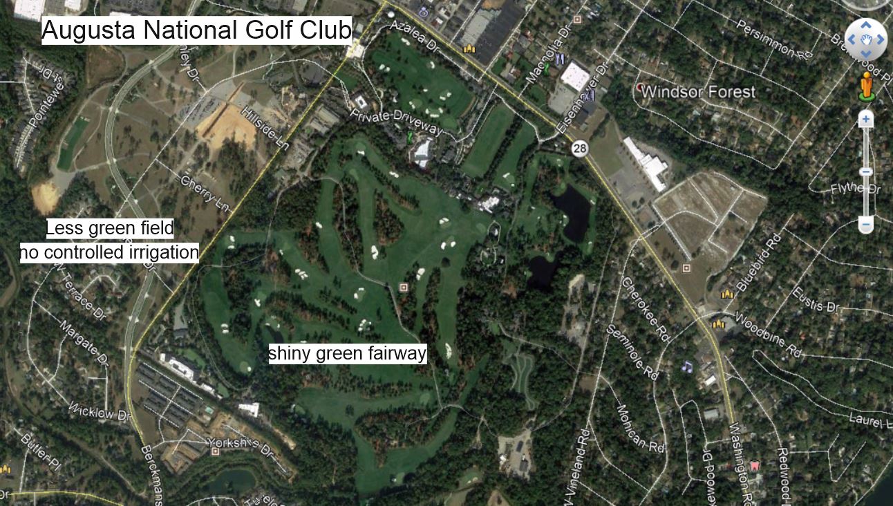
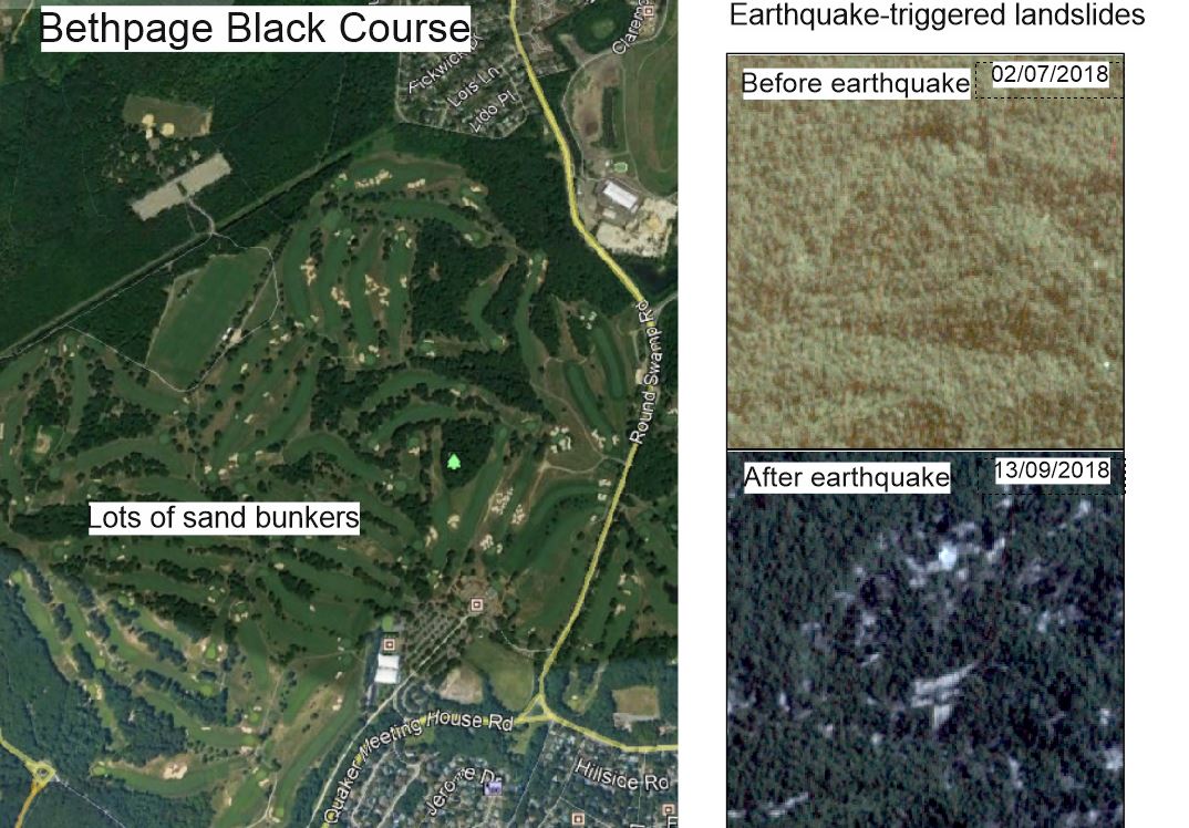
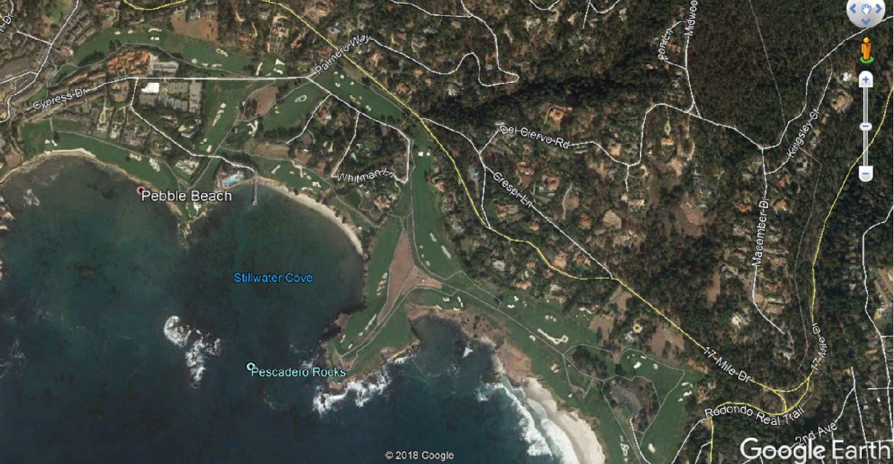
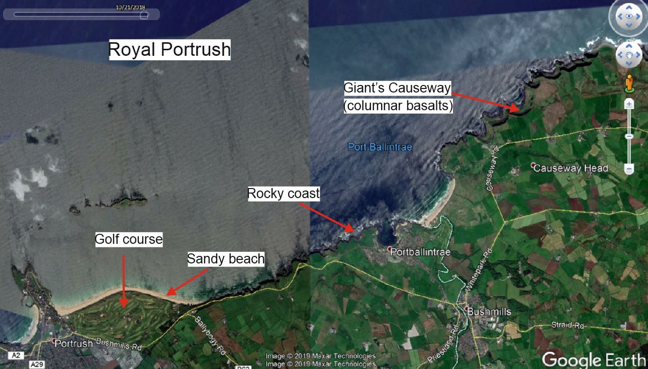
Figure 1: Masters Tournament – Augusta National Golf Club, Georgia. One can clearly spot the difference in color between the shiny green fairways and the (less-shiny) fields outside the golf course. Figure 2: PGA Championship, Bethpage Black Course, Farmingdale, New York. The aerial view of bunkers remembered me earthquake-triggered landslides as seen from satellite data; to the right, an example of landslides triggered by a seismic sequence in Lombok (Indonesia). Figure 3: US Open, Pebble Beach Golf Links, California. Come on, PEBBLE is clearly a geological term! Plus wonderful location at the seaside with coves, inlets and promontories. Matter for scientists studying currents and sediments! Figure 4: The Open Championship, Royal Portrush, Northern Ireland. I’ve been in Portrush on holiday in 2016 and I didn’t know of the golf course!