High-resolution mapping through LiDAR-drone system: Sciences and Technology in geological hazards
Italy leads most of the bucket lists of almost any traveler around the World. Particularly for nature-Earth’s history-rocks lovers (aka Geoscientists), Italy offers us many opportunities to explore and address many questions. However, nature sometimes surprises us, and not everything is exciting.
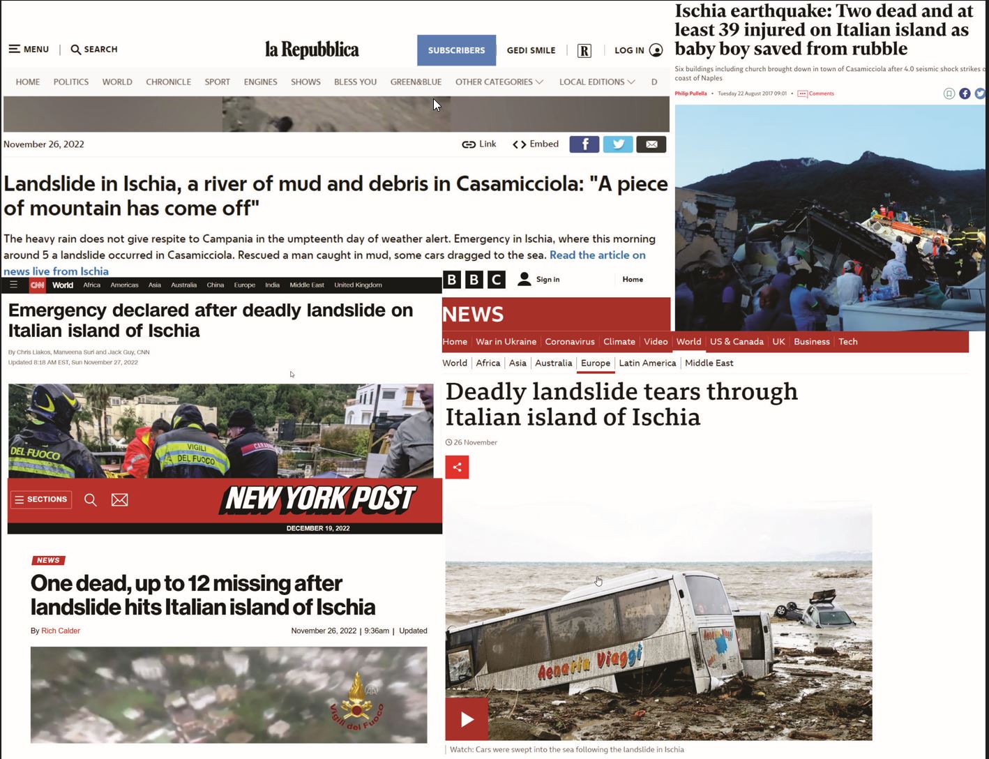
Natural disasters are a country-wide issue. It is scary to believe that around 95% of Italian places are at risk of natural disasters, ranging from floods, landslides, mudslides, and coastal erosion to volcanic eruptions and earthquakes. Unfortunately, Ischia Island, a volcanic caldera near Naples, has been the perfect target for these natural events due to its particular geological and geomorphological context.
A few weeks ago, a terrible landslide rocked the island; this event was sadly no news. In 2017 the island was struck by an earthquake.
If someone asks me why I like research, I would answer that research is the best friend of a curious mind. However, research, in addition to satisfying human curiosity, should serve the needs of society. What are science and technology if we use them without tangible benefit for living beings on Earth?
Because of the abovementioned, Ischia is an excellent place to fit my Ph.D. research project. We can decipher the complex geological settings to provide a solid basis to prevent people at high risk of any geological disaster.
The deformation processes control the landforms and geomorphological evolution. Its surface features can also be identified and interpreted through morpho-structural analysis to understand its structural arrangement and evolution as an active and recent caldera. By understanding these aspects, I aim to comprehend better volcanic caldera’s structural architecture, which is helpful in assessing and managing geological hazards.
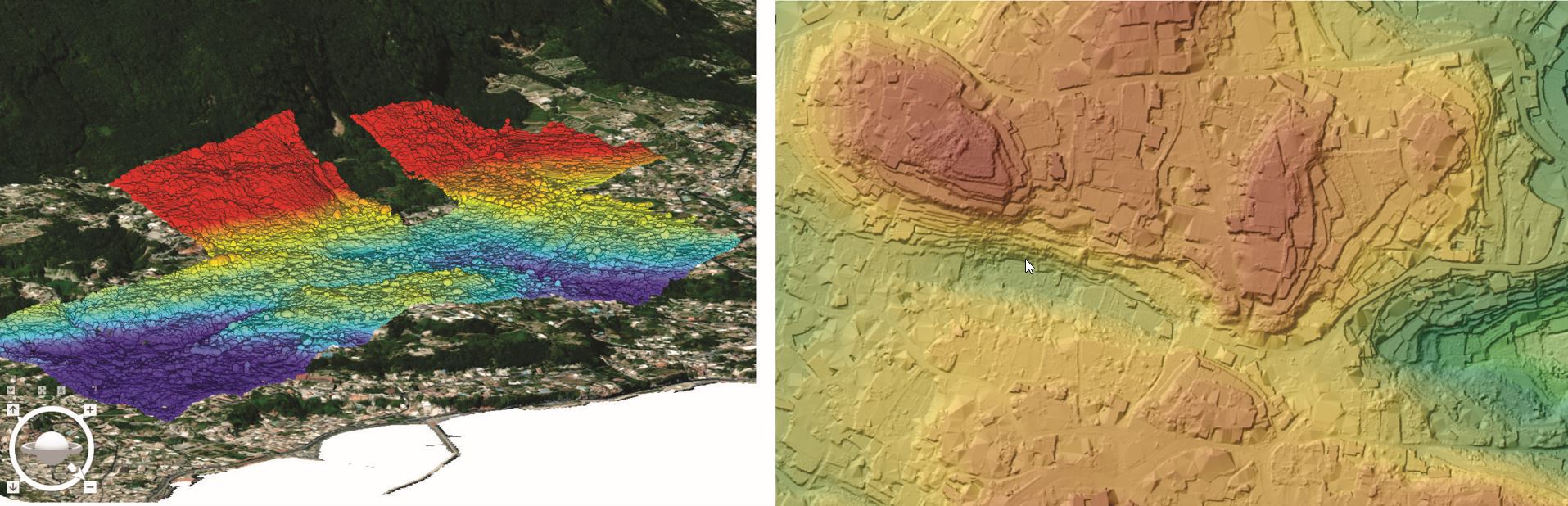
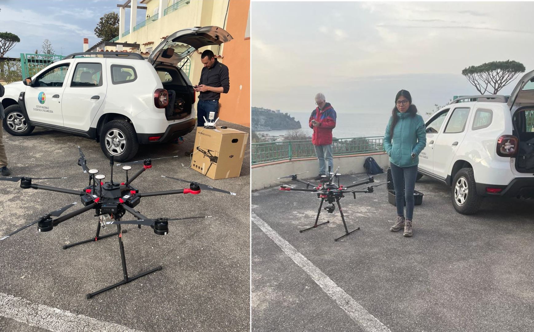
During the first year of my research, I used a LiDAR-Drone-based to build up high-resolution DTMs to the north part of Epomeo Mt., covering part of the town of Casamicciola Terme, the most recently damaged area by the last landslide and place of the earthquake in 2017. This research was conceived and coordinated by Rosa Nappi, INGV-Osservatorio Vesuviano, Naples, to whom I am greatly indebted. Flight missions were carried out in a great collaboration with Dr. Gianluca Norini from the Consiglio Nazionale Delle Ricerche, Milan (CNR), who oversaw piloting the takeoff and landing of the LiDAR-drone. We covered the W-E fault structure presumably responsible for the active movements and historical earthquakes in the Casamicciola area.
Enhancing this technology’s applicability and improving Ischia Island’s volcano-tectonic model has been an exciting and challenging process. During this stage of my research, I look to provide: 1) a baseline methodology for future mapping missions using Digital Elevation Models with high resolution (up to 10 cm of resolution) and 2) improve the understanding of the geological evolution of the area.