Assessment of attenuation regressions for earthquake-triggered landslides in the Italian Apennines
A new Perigeo-branded paper is now online! The paper is available here; if you can’t wait, here’s a summary of the main outcomes! AAAAnd stay tuned, next week a new post on another paper!
The Apennines are prone to earthquakes, and earthquakes commonly produce landslides. How the number of landslide decay with distance from the fault or from the epicenter? Can we compare inventories related to events occurred hundreds of years apart?
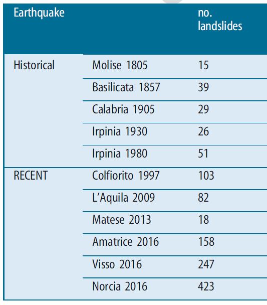
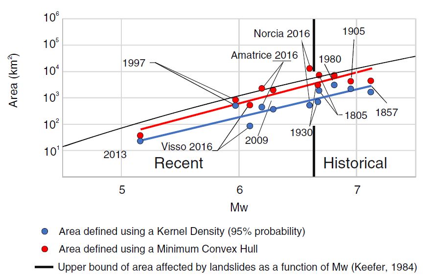
We analyzed the earthquake-triggered landslides for 11 events occurred in the Central and Southern Apennines since 1805 (Figure 1). We divided them into “historical” and “recent” datasets and we compute the area affected by landslides using two approaches: a minimum convex hull (MCH) and a kernel density estimator (KDE). The former approach defines the minimum convex polygon enclosing all the observations. In the second approach, we calculated the areal density of landslides and considered the contour of the 95° percentile.
The minimum convex hull is more conservative and sensitive to single observations in the far field (possibly outliers); both MCH and KDE are consistent with previous data (e.g., Keefer 1984; Figure 2).
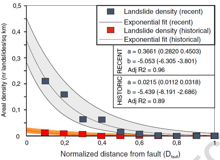
Then, we calculated an attenuation regression, fitting the empirical distribution of landslides areal density (i.e., number of landslides/km2) as a function of the distance from both the surface fault trace and from the epicenter. We considered separately recent and historical inventories; the attenuation with distance from fault is more reliable and best fit by an exponential functional form.
The landslide density of historical events is significantly lower than that of recent events (Figure 3), due to incompleteness of the dataset. Nevertheless, if correctly scaled, historical events may provide reliable information, useful for extending the number of case histories.
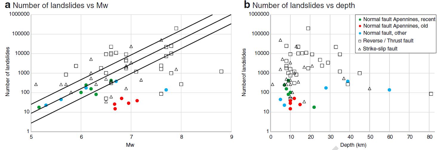
But what happens outside the Apennines? To answer this question, we compared our dataset with worldwide earthquakes. Figure 4 prompt two main observations:
- Normal faulting earthquakes produce fewer landslides than reverse and strike-slip events, thus style of faulting influences the number of triggered landslides.
- In the Apennines, old events generated a smaller number of landslides despite having a higher magnitude: again, it is important to consider this issue when comparing modern and old datasets.
References:
Keefer, D. K.: Landslides caused by earthquakes, GSA Bulletin, GeoScienceWorld, Available from: https://pubs.geoscienceworld.org/gsa/gsabulletin/article-abstract/95/4/406/202914
Malamud BD, Turcotte DL, Guzzetti F, Reichenbach P (2004a) Landslides, earthquakes, and erosion. Earth Planet Sci Lett 229(2004):45–59