Geological and Environmental Evolution of Casamicciola Terme — Insights from the 2017 Earthquake and the 2022 Landslide
In the northern part of Ischia Island, the town of Casamicciola Terme has been repeatedly affected by natural disasters in recent years. After the earthquake of August 21, 2017, the same area was struck again by a major landslide on November 26, 2022.
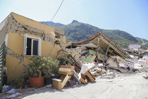
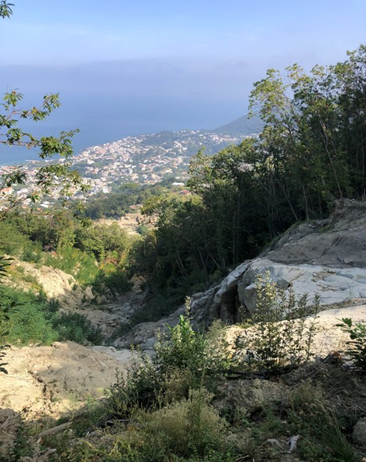
This region is particularly prone to such events due to its steep slopes and loosely consolidated surface materials. Earthquakes act as powerful triggers, weakening the ground and setting unstable masses into motion—making slope instability a persistent risk.
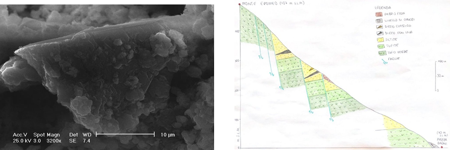
As part of her Master’s thesis, Magda Ciullo carried out a comprehensive study of the 2022 landslide. Her research combined detailed fieldwork with advanced laboratory techniques, including petrographic analysis, radiocarbon (C-14) dating, and scanning electron microscopy (SEM) for mineral identification.
Thanks to this integrated approach, Magda was able to place the previously uncharacterized landslide deposits within the broader lithostratigraphic framework of the Ischia caldera. By carefully analyzing small-scale deposits, she reconstructed the tectonic setting of the event, identifying fault systems that influence both the spatial distribution of outcrops and the overall slope stability of Mount Epomeo.
This study provides an important foundation for a more integrated understanding of the geological and structural dynamics of the northern slope of Mount Epomeo. Magda’s work offers valuable insights for assessing hydrogeological and seismic hazards and can serve as a starting point for future research, land-use planning, and risk mitigation strategies.

Congratulations Magda for this work and all the best in your career as Earth Sciences professional.